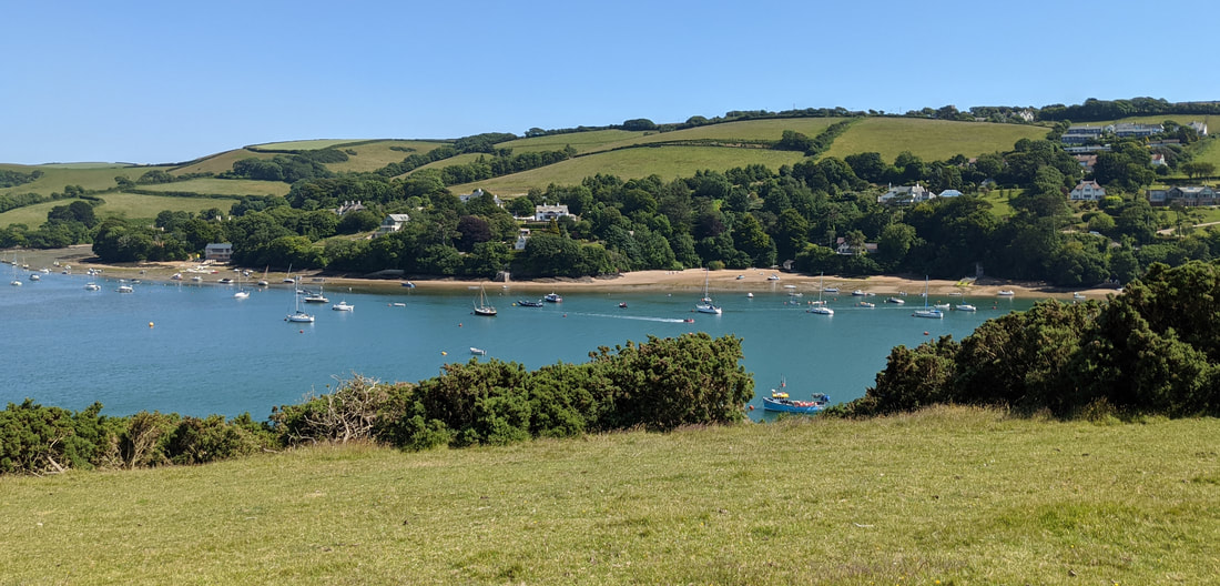
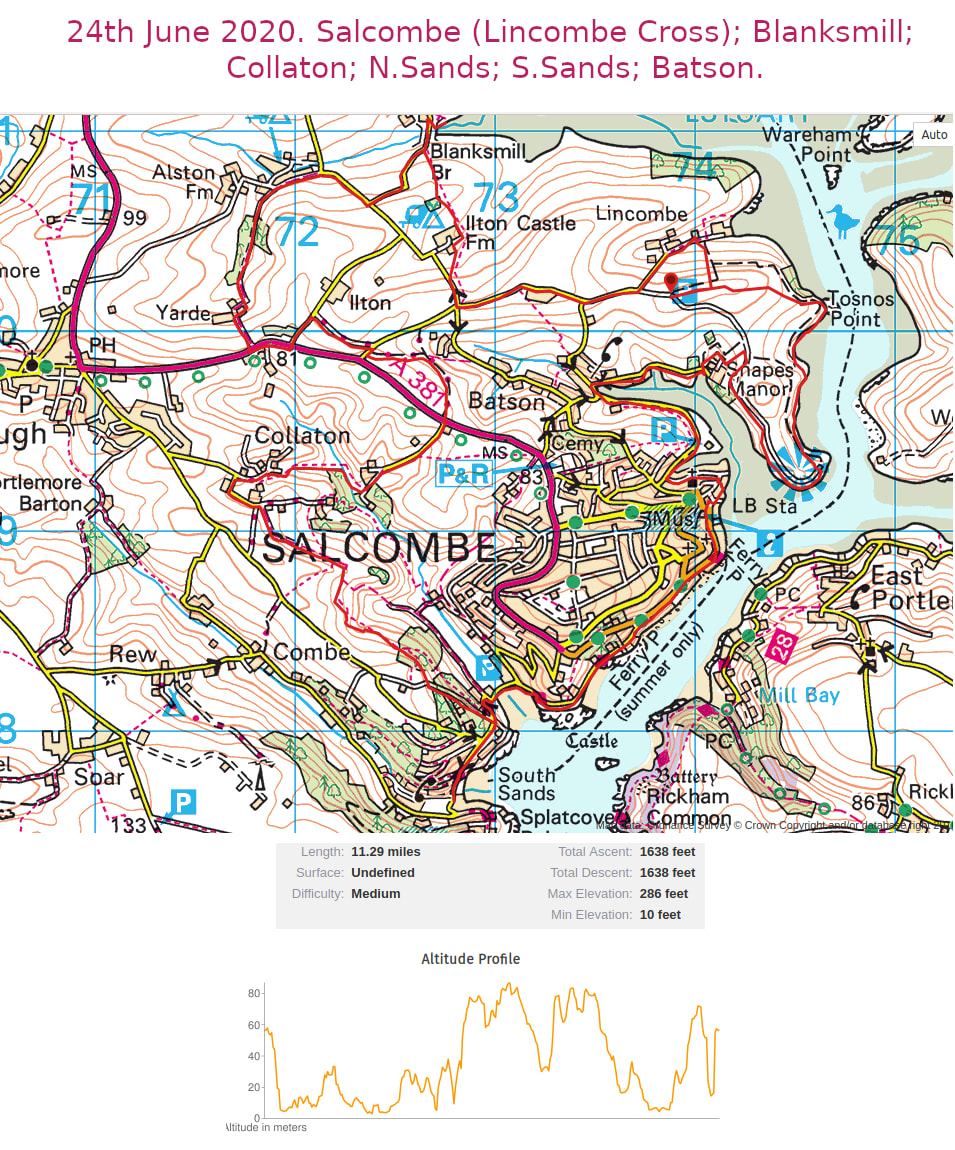
This walk/route is based around the town of Salcombe and starts at the N.T. car park near Lincombe Cross. George planned this new route, for what turned out to be an exceptional day with clear skies; high temperatures (around 29º C) and a light breeze. The views were spectacular throughout the whole day, particularly from Snapes Point, looking North along the estuary to Kingsbridge, S.Pool and Frogmore. The Southerly direction of course was looking out to sea, towards Prawle Point. Our lunch stop at Collaton farm/complex was particularly poignant as Roger tells us that he lived there many years ago. Anyway a very tranquil spot!
Total Distance 11.1 miles. Summated elevation 2252 ft.!…….Mike
Total Distance 11.1 miles. Summated elevation 2252 ft.!…….Mike
| salcombe_estuary.gpx |