Newbridge; Poundsgate; Leusdon; Jorden; Buckland-in-the-Moor. 12th December 2018. 9 miles.
Wednesday 24th April 2019.
The Weather Forecast for the day was poor. Heavy showers through the morning and until 14.00 hrs. In the event, some light rain until 11.00 hrs then fine all day, with sunshine post 14.00hrs.
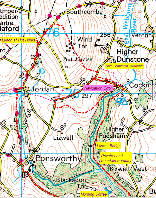
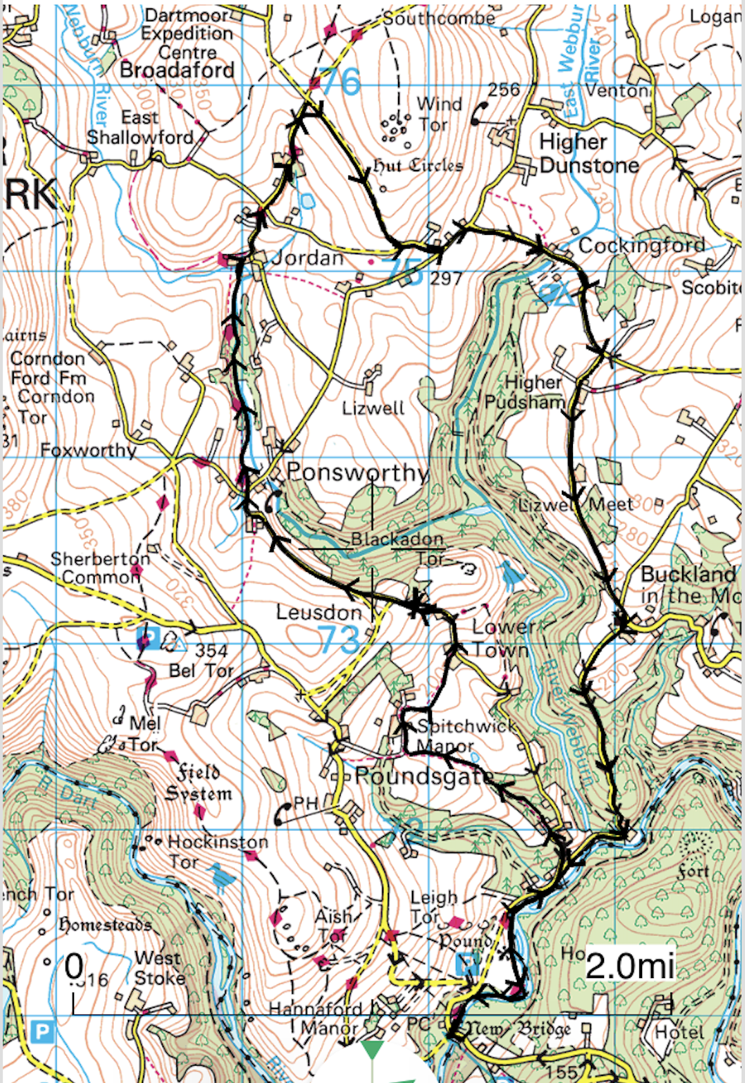
We last undertook this walk on 12 December 2018, where I made reference to a possible alternative future route from Cockingford through Hr Pudsham Forest to Buckland Woods, thus avoiding a considerable distance of ‘road walking’. The occasion seemed opportune to hone our navigation skills by trying some route variations. (See map below) Firstly from Cockingford towards Lizwell Bridge(and Rock), via the left-hand bank of the Webburn, which ended in failure (unless wishing to return to Jordan). Secondly, taking the route as described above, down the Eastern bank of the Webburn to its confluence with the River Dart. This was highly successful, albeit accepting the passage over Fountain Forestry, private land. Apart from the access and egress points the route was quite simple. I understand however, it is possible to obtain a permit from Fountain Forestry to access all the private woodland. This area in particular is quite well known for its rock formations and of course the ancient Lizwell Bridge.
Total route distance (including errors) for the day. 11.2 miles, measured from my ‘Memory Map’ PC programme. Summated elevation 1900 ft.
I have to admit that my View Ranger, iPhone App, failed to record the complete route (75 %), because of battery failure. Always in the past, the GPS App has shown a greater distance, in comparison; because of its ability to measure all small deviations……….Mike
The Weather Forecast for the day was poor. Heavy showers through the morning and until 14.00 hrs. In the event, some light rain until 11.00 hrs then fine all day, with sunshine post 14.00hrs.
We last undertook this walk on 12 December 2018, where I made reference to a possible alternative future route from Cockingford through Hr Pudsham Forest to Buckland Woods, thus avoiding a considerable distance of ‘road walking’. The occasion seemed opportune to hone our navigation skills by trying some route variations. (See map below) Firstly from Cockingford towards Lizwell Bridge(and Rock), via the left-hand bank of the Webburn, which ended in failure (unless wishing to return to Jordan). Secondly, taking the route as described above, down the Eastern bank of the Webburn to its confluence with the River Dart. This was highly successful, albeit accepting the passage over Fountain Forestry, private land. Apart from the access and egress points the route was quite simple. I understand however, it is possible to obtain a permit from Fountain Forestry to access all the private woodland. This area in particular is quite well known for its rock formations and of course the ancient Lizwell Bridge.
Total route distance (including errors) for the day. 11.2 miles, measured from my ‘Memory Map’ PC programme. Summated elevation 1900 ft.
I have to admit that my View Ranger, iPhone App, failed to record the complete route (75 %), because of battery failure. Always in the past, the GPS App has shown a greater distance, in comparison; because of its ability to measure all small deviations……….Mike