Drewsteignton; Two Moors Way; Hittisleigh; Crockernwell; Prestonbury Castle. 11 Miles, 26th February 2014.
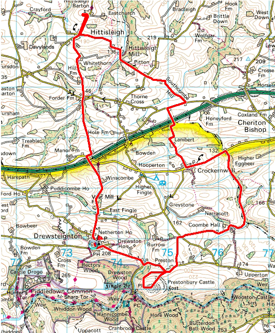

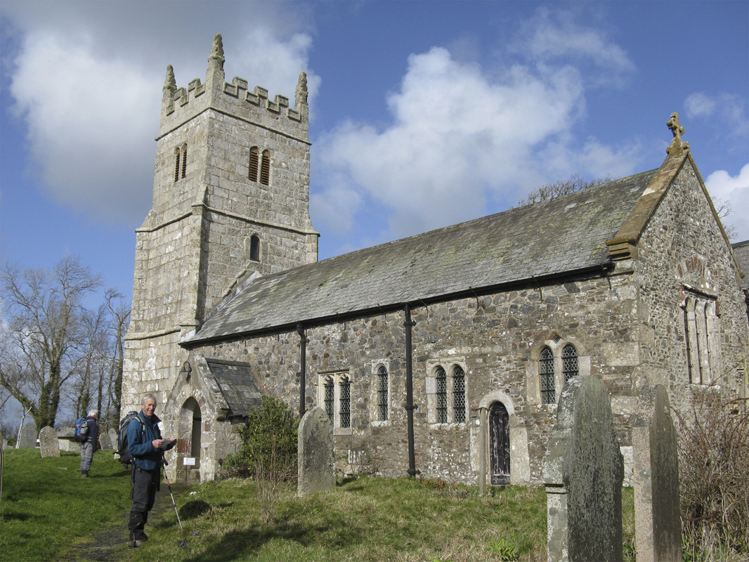
This is a medium distance walk, through mainly farmland; small villages and some roadwork; albeit on quiet minor roads. The highlights are to visit the small church at Hittisleigh and the iron age fortress/castle at Prestonbury Interestingly, this castle is one of four in close proximity to Fingle Bridge. The other iron age fortresses are Cranbrook, approx one mile in a southerly direction across the valley and Woolstone Castle, again across the valley, approx one mile East, towards Clifford Bridge. The fourth unit is of course the modern age Castle Drogo, constructed between 1911 and 1930. It certainly would be an interesting study to understand the reasons for the three 6th Century Castles. Doubtless at Exeter Museum or indeed some local Primary School; models would have been built, to try and analyse the epoch of the three age division of Stone Age; Bronze Age and Iron Age!
The hike across the fields to Prestonbury is over private land and and I understand, the owner is reluctant to allow passage!
I’ve included a photo of a herd of black cows who greeted us in exactly the same field as we experienced some 3 years ago. Not the same cows, just the same colour!
Total Distance 10.1 miles. Ascent/descent 1950 ft.
Wednesday 26th May 2021. What a transformation, with the weather pattern over the last few weeks! Pretty well, wall to wall sunshine all day, although the ‘going’ underfoot was poor after the recent heavy rain.
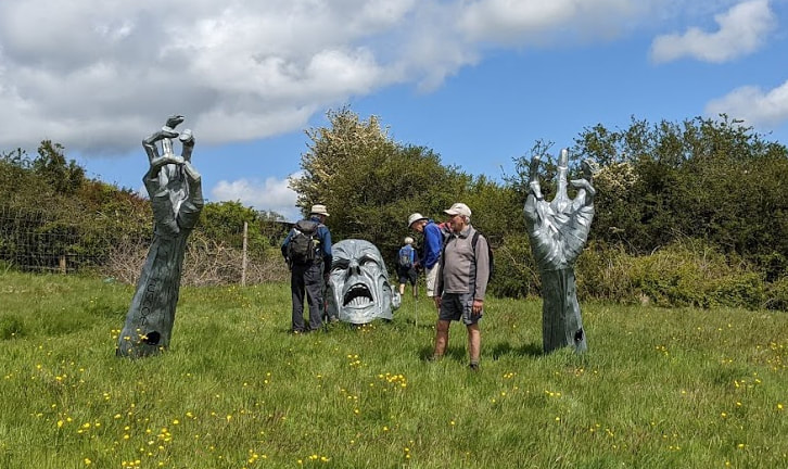
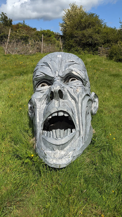
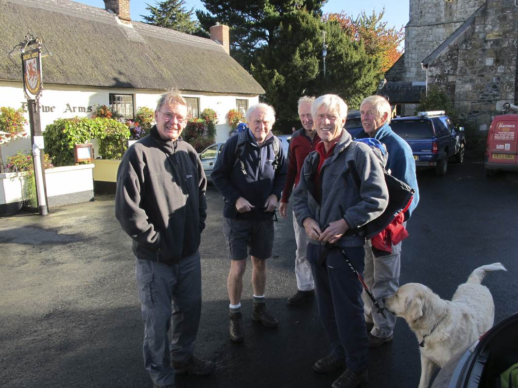
Almost a full turnout with 7 team members, meeting in the car park below the church at Drewsteignton. Our route takes us through woodland and arable farm land. We arrive in a field to witness a terrible scene whereby a grotesque character is sinking into oblivion. Closer inspection reveals the object to be made entirely from metal, welded with some skill to represent the excess proportions of a metal monster. Somebody must have a sense of humour!
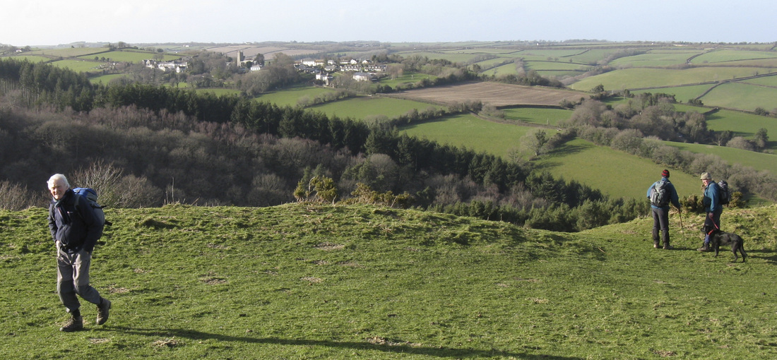
On previous visits we have been able to divert to the Iron Age fortress at Prestonbury. We have always been aware that the land-owner was reluctant to allow walkers over his land, and on this occasion it was fairly obvious, with 2 or 3 notices to this effect, positioned at access points. This created an amendment to our usual return route, by following a pathway through the exceptionally pleasant, Drewston Wood; demonstrating the delicate colours of the new seasons growth.
Total Distance 9.82 miles (10.0 miles); summated elevation 1614 ft. A considerable amount of robust climbing?……….Mike
The hike across the fields to Prestonbury is over private land and and I understand, the owner is reluctant to allow passage!
I’ve included a photo of a herd of black cows who greeted us in exactly the same field as we experienced some 3 years ago. Not the same cows, just the same colour!
Total Distance 10.1 miles. Ascent/descent 1950 ft.
Wednesday 26th May 2021. What a transformation, with the weather pattern over the last few weeks! Pretty well, wall to wall sunshine all day, although the ‘going’ underfoot was poor after the recent heavy rain.
Almost a full turnout with 7 team members, meeting in the car park below the church at Drewsteignton. Our route takes us through woodland and arable farm land. We arrive in a field to witness a terrible scene whereby a grotesque character is sinking into oblivion. Closer inspection reveals the object to be made entirely from metal, welded with some skill to represent the excess proportions of a metal monster. Somebody must have a sense of humour!
On previous visits we have been able to divert to the Iron Age fortress at Prestonbury. We have always been aware that the land-owner was reluctant to allow walkers over his land, and on this occasion it was fairly obvious, with 2 or 3 notices to this effect, positioned at access points. This created an amendment to our usual return route, by following a pathway through the exceptionally pleasant, Drewston Wood; demonstrating the delicate colours of the new seasons growth.
Total Distance 9.82 miles (10.0 miles); summated elevation 1614 ft. A considerable amount of robust climbing?……….Mike
| drewsteignton-walking-26-may-2021-at-09-54.gpx |
Drewsteignton 20th October 2010 by Alan.
Drewsteignton from Prestonbury Castle 26th February 2014 by Brian
Hittisleigh Church, 26th February 2014 by Brian.